
Water Well Drilling Josephine County Oregon
Call us TODAy
✓ Call Your Local Well Drilling Experts
✓ Request a Free Drilling Quote
✓ Plan Your Well With Local Experience
✓ Start Your Water Well Project Today
Water Well Drilling
Planning a dependable water well in Josephine County requires an understanding of river-valley sediments, mountain bedrock and the county’s complex mineral geology. Properties near Grants Pass may encounter gravel, sand, clay and weathered rock, while rural parcels around Cave Junction, Williams, Selma and Wolf Creek may rely on fractures in granite, metamorphic rock, serpentine or other consolidated formations.
Enloe Drilling & Pumps provides professional water well drilling in Josephine County, Oregon for homeowners, ranchers, farmers and commercial property owners. Our multigenerational team reviews nearby Oregon well reports, expected geological conditions, access requirements and the property’s total water demand before recommending a drilling plan.
Properties within Grants Pass and other developed areas may have access to a public or community water system. Private wells are more common on rural homesites, farms, forest parcels and undeveloped land beyond existing water-service boundaries.
Local Geology and Drilling Conditions in Josephine County
Josephine County extends from the Rogue River Valley into the Illinois Valley and surrounding Klamath Mountains. This creates a mixture of unconsolidated river deposits, basin-fill sediment, granite, metamorphic formations and ultramafic rock.
Groundwater may occur between grains of sand and gravel, within weathered rock or inside fractures and faults. The geology beneath an individual parcel determines the drilling method, casing requirements and potential production of the completed well.
Rogue River and Grants Pass Valley Deposits
Properties near Grants Pass, Merlin, Murphy and the Rogue River may encounter layers of sand, gravel, cobbles, clay and weathered rock deposited by the river and its tributaries. These unconsolidated deposits are important local aquifers.
Coarse gravel and sand can transmit substantial groundwater when the deposits are thick and connected to a dependable recharge area. Fine clay may store water but release it too slowly to support the required pumping rate.
Loose gravel, cobbles and sand can make the borehole unstable. Proper casing and screen selection may be needed to support the well and prevent sediment from entering the pump.
Shallow groundwater near developed land can be more vulnerable to contamination from septic systems, fuel storage, livestock areas and surface runoff. Correct siting and sanitary sealing are essential.
Illinois Valley Basin Fill
The Illinois Valley around Cave Junction, Kerby, Selma and O’Brien contains alluvial material carried into the basin by the Illinois River and surrounding creeks. Drilling may encounter changing layers of clay, gravel, sand and boulders.
Individual layers can vary considerably in thickness and permeability. One gravel interval may provide a strong supply, while another may be surrounded by clay and have limited connection to regional recharge.
Groundwater levels in these shallow deposits can change between wet winters and dry summers. Irrigation, nearby wells and extended drought can also affect the available water column.
A deeper well is not automatically more productive. The objective is to identify and complete the well in formations that can supply the required volume without creating excessive sand or drawdown.
Granite, Metamorphic Rock and Serpentine
Mountain and foothill properties may encounter granite, granodiorite, metamorphic formations, greenstone, serpentine and other hard rock associated with the Klamath Mountains. These rocks generally produce groundwater through fractures, joints and weathered zones.
A productive fracture may support a rural home, while nearby solid rock may release very little water. The depth and position of water-bearing fractures cannot be predicted from surface appearance alone.
Josephine County’s mineral-rich geology can also influence water chemistry. A newly completed well should be tested before household use, particularly where unusual rock formations or historic mining activity occur nearby.
Typical Water Well Depths in Josephine County
Josephine County contains thousands of private wells with a wide range of completed depths. Nearby well reports are useful planning tools, but they cannot guarantee the depth or production of a new well.
Aggregated Oregon Water Resources Department records indicate a countywide median completed depth of approximately 126 feet. Half of recorded wells fall within a broad range of approximately 90 to 200 feet. More recently constructed wells tend to be deeper, with wells completed since 2016 showing a median near 180 feet.
Local records show median depths of approximately 130 to 145 feet around Grants Pass, 136 feet near Merlin, 140 feet near Williams and 110 feet near Cave Junction. Wells around Murphy and Wilderville have median depths closer to 150 feet.
Some properties obtain adequate groundwater at less than 100 feet. Difficult fractured-rock locations may require drilling to 300, 400 or more than 600 feet before an appropriate supply is found.
Before developing a Josephine County drilling plan, we consider:
- Oregon well reports located near the property
- Completed depths, static water levels and reported flow rates
- The property’s position within the Rogue or Illinois Valley
- Whether nearby wells draw from basin sediment or bedrock fractures
- Seasonal water-level changes and long-term drought conditions
- Known groundwater quantity concerns in the surrounding area
- Nearby domestic, commercial and agricultural pumping
- The required household, livestock or irrigation volume
- Potential contamination from septic systems or historic mining
- Space for pumps, pressure equipment and storage tanks
The final depth should be based on the formations and water production encountered during drilling. Copying a neighbour’s depth does not guarantee the same result.
Residential and Agricultural Water Requirements
Residential Water Wells in Josephine County
A domestic well must supply drinking water, bathrooms, laundry, kitchen appliances and outdoor faucets. Rural properties may also need water for gardens, guest accommodation, workshops, animals and fire-protection storage.
The well system should be designed for peak demand as well as average daily consumption. Several showers, a washing machine and outdoor watering can operate during the same short period.
A well with a modest recovery rate may still support a home when it is paired with sufficient storage. The well fills the tank at a controlled rate, while a separate pressure pump meets heavier short-term demand.
Benefits of a properly designed residential well system include:
- An independent water supply for qualifying rural properties
- A pump matched to the well’s tested recovery rate
- Storage options for moderate-producing bedrock wells
- Reduced drawdown during periods of high demand
- Water planning for homes, gardens and limited livestock
- Less frequent pump cycling and equipment wear
- Documented construction for future maintenance
New well water should be tested before regular use. Testing should consider total coliform bacteria, nitrate, arsenic and any additional substances associated with local geology, nearby mining or surrounding land uses.
Agricultural and Rural Property Wells
Josephine County supports vineyards, hay fields, pasture, livestock, nurseries, orchards and small specialty farms. These operations may require sustained pumping during the hottest and driest part of the year.
An agricultural system should be designed around the acreage, crop requirements, irrigation method, livestock numbers and daily pumping schedule. The well, pump, electrical supply, storage and distribution equipment must function as one coordinated system.
Oregon exempts certain groundwater uses from the standard water-right permitting process. Qualifying domestic use and stock watering are common examples. Larger irrigation, commercial or industrial uses generally require approval from the Oregon Water Resources Department.
Drilling a productive well does not automatically authorise unrestricted irrigation. Confirm the proposed use and any water-right requirements before construction begins.
Access Considerations for Rural Josephine County Properties
Many Josephine County parcels are located along narrow mountain roads, forest tracks and steep private driveways. A drilling rig and its support vehicles require considerably more space and road strength than an ordinary pickup.
Remote access can become difficult during winter rain, wildfire season or following storm damage. Soft ground, washed-out roads and low branches can delay mobilisation.
Before equipment is moved onto the property, we assess:
- Road and driveway width
- Steep grades and sharp switchbacks
- Gate openings and available turning space
- Bridge, culvert and cattle-guard capacity
- Soft ground and unstable road shoulders
- Overhead power lines and low tree branches
- Wildfire damage and hazardous trees
- Underground utilities and irrigation pipes
- Space for the rig, support trucks and casing
- Distance from septic and contamination sources
- Permanent access for future pump servicing
Some hillside sites require grading to create a stable drilling pad. Access roads may need gravel or temporary reinforcement before heavy vehicles arrive.
The wellhead should remain accessible after construction. Pumps may eventually need inspection or replacement, and service equipment must be able to operate directly above the well.
Oregon Well Permits and Construction Requirements
Water well construction in Josephine County is regulated primarily by the Oregon Water Resources Department. A licensed and bonded Oregon well constructor normally drills the well, files the required start card and submits a well report after construction.
New wells serving exempt groundwater uses are subject to Oregon’s recording requirements. The well constructor generally submits a map showing the well’s location and the applicable recording fee with the completed well report.
Oregon construction rules address casing, seals, surface protection and separation from possible contamination sources. A water supply well generally cannot be placed within 100 feet of a septic drainfield or sewage-disposal facility unless an approved exception applies.
Josephine County’s On-Site Septic Program handles local septic applications and inspections. The well, septic tank, primary drainfield and replacement drainfield should be planned together before construction begins.
Some proposed land divisions in documented groundwater quantity problem areas may require a pump test. Josephine County can use the results to evaluate whether the proposed wells could affect existing, properly constructed wells.
The normal process includes:
- Confirming whether public or community water is available
- Defining the proposed domestic, agricultural or commercial use
- Determining whether an Oregon water right is required
- Reviewing nearby well reports and groundwater concerns
- Selecting a site that meets current separation standards
- Coordinating the well location with the septic plan
- Preparing the access road and drilling pad
- Submitting the required start notification
- Drilling and installing approved casing and seals
- Developing and testing the completed well
- Selecting the pump, pressure controls and storage capacity
- Filing the well report, location map and recording documents
Water-right rules, land-use requirements and fees can change. Property owners should confirm current procedures with the Oregon Water Resources Department, Josephine County Planning Department and Josephine County On-Site Septic Program.
Communities We Serve in Josephine County
Our Josephine County water well drilling service includes qualifying properties in and around:
- Grants Pass
- Merlin
- Murphy
- Wilderville
- Williams
- Cave Junction
- Selma
- Kerby
- O’Brien
- Wolf Creek
- Galice
- Sunny Valley
- New Hope
- Wonder
- Rural properties throughout the Illinois Valley
Illustrative Josephine County Water Well Drilling Scenario
The following example demonstrates how a typical Josephine County project could be planned. It is an illustrative scenario and is not presented as a completed Enloe customer project.
Imagine a family developing a rural property outside Williams. Their plans include a three-bedroom home, a workshop, a greenhouse, a small garden and water for several goats. No public water system serves the parcel.
Nearby well reports show different completed depths because some wells depend on weathered rock while others reach deeper fractures. The proposed well site must also remain clear of the septic drainfield, animal enclosure and seasonal drainage channel.
The first step would be to calculate the household, livestock and greenhouse demand. The access road would then be assessed for width, low branches, turning space and the condition of a small culvert near the entrance.
Suppose the completed well produces a consistent but moderate flow. Instead of selecting an oversized pump, the system could use a pump matched to the tested recovery rate and a storage tank capable of supporting peak household and greenhouse demand.
The greenhouse and garden could be watered in separate zones during off-peak periods. This design would protect the well from unnecessary drawdown while providing a practical supply for the property.
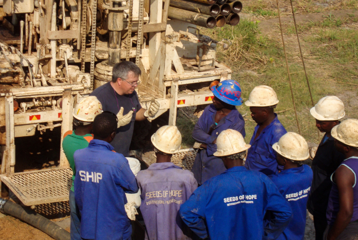
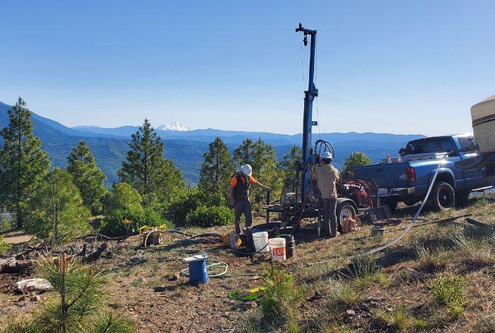
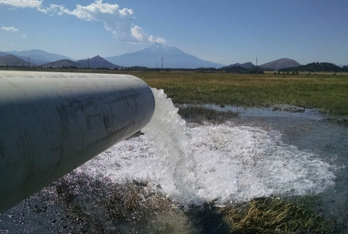
Images of some of our Drilling Projects


Benefits of Well drilling in Josephine County, Oregon
Josephine County wells can encounter loose river gravel, clay, boulders, weathered granite and unpredictable fractured rock. Experience with these changing conditions helps the drilling crew make practical decisions as the borehole advances.
Choosing Enloe Drilling & Pumps provides several advantages:
- Multigenerational water well drilling experience
- Knowledge of Southern Oregon valley and mountain geology
- Planning informed by nearby Oregon well reports
- Residential, agricultural and commercial drilling capabilities
- Well development, production testing and pump services
- Storage options for modest-producing fractured-rock wells
- Practical preparation for remote and difficult-access properties
- Clear explanations of depth, yield and equipment choices
We do not guarantee a fixed depth or flow rate before drilling begins. We review the available records, prepare for likely formations and design the final system around the conditions and groundwater encountered.
Your questions answered
FAQ About Water Well Drilling in Josephine County, Oregon
What is the typical water well depth in Josephine County?
Aggregated well records indicate a countywide median completed depth of approximately 126 feet, with many wells between about 90 and 200 feet. Recently constructed wells have a median closer to 180 feet. Some fractured-rock properties require drilling to 300 feet or considerably deeper.
Why can neighbouring wells have different depths and yields?
Groundwater does not occur evenly throughout Josephine County’s rocks and sediments. One well may intersect productive gravel or an open fracture, while another nearby well encounters clay or solid rock. Nearby records provide guidance but cannot guarantee identical results.
Do I need a water right for a domestic well?
Qualifying domestic groundwater use of up to 15,000 gallons per day is generally exempt from Oregon’s standard water-right permitting process. The well must still comply with state construction, setback, reporting and recording requirements.
Can Josephine County require a pump test?
Potentially. Certain land divisions in documented groundwater quantity problem areas may require a pump test to demonstrate the proposed supply and assess possible effects on existing wells.
How should I prepare a remote property for well drilling?
Provide a stable road with enough width, overhead clearance and turning space for heavy vehicles. Mark utilities, septic components and irrigation lines. Check gates, culverts, bridges and steep sections before the drilling equipment arrives.
Locations in Oregon we Service
5 Interesting Facts About Josephine County, Oregon
- Josephine County was named after an early female settler. The county was established in 1856 and named for Virginia Josephine Rollins, recognised as the first American woman to settle in the area.
- Grants Pass is the county seat. The city’s name originally referred to General Ulysses S. Grant’s military success. The word “Pass” was added to distinguish the community from Oregon’s Grant County.
- Josephine County contains Oregon’s famous marble caves. Oregon Caves National Monument and Preserve protects a rare cave system formed as naturally acidic groundwater slowly dissolved marble bedrock.
- The Rogue River was one of America’s original Wild and Scenic Rivers. An 84-mile section of the lower Rogue was included in the original Wild and Scenic Rivers Act of 1968.
- Josephine County has unusually diverse geology. The area contains granite, serpentine, marble, sedimentary rock and remnants of ancient oceanic crust. This geological variety influences the county’s scenery, mineral history, soils and groundwater conditions.
Read Our Latest Blogs
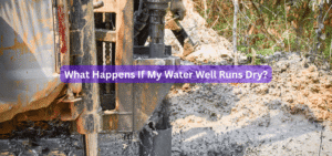
What Happens If My Water Well Runs Dry?
If your water well runs dry, the first thing you should do is switch off power to the well pump and stop using water. Continuing
Can You Have a Well in an Urban Area?
Yes, you can have a water well in some urban areas, but approval depends on local regulations, your intended water use, groundwater conditions, and the
Do I Need a Permit to Drill a Water Well?
You need to check the applicable well-construction requirements before drilling a water well. In Northern California, you must obtain a well permit from the local
Get in Touch
For all your water well drilling and pump needs contact us today
Address
507 Hummingbird Lane, Talent, OR 97540
Enloedrillingandpumps@gmail.com
Call Us
530-964-2807